")


GRAPHAB 2
- Landscape graphs to assess and mitigate the impact of transportation infrastructures on species
Landscape graphs to assess and mitigate the impact of transportation infrastructures on species
Context and objectives
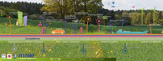
For some ten years, landscape graphs have been widely used for modeling ecological networks and measuring landscape connectivity from an operational perspective. A landscape graph is a set of nodes (habitat patches for a given species or group species) potentially connected by links representing the functional connectivity between each pair of nodes. It is built from a land cover map combined with data on habitat and movement of the species under study. With their simple design, their limited requirement of input data and their ecological relevance, graph-based methods can serve as a guide for planning decision-making, especially for the conservation of ecological networks. In this perspective, Graphab 2 project aims to use landscape graphs to assess the impact of transport infrastructures on the functionality of ecological networks, and to provide guidance for locating mitigation (wildlife crossing structures) and compensation (habitat restoration/creation) measures.
Infrastructure impact assessment of the genetic structure of a population
In the first part, the project was focused on the use of genetic data acquired for a bat species (the lesser horseshoe) in Franche-Comté. The aim was to develop a protocol to assess the impact of a transport infrastructure on the degree of isolation of subpopulations. A field survey has been done in a series of maternity roosts, to retrieve DNA samples of individuals of this species. These samples have been submitted to an analysis of molecular biology, leading to characterize the genetic signature of each roost. The results showed that there was a close link between the spatial structure of these genetic data and the configuration of the graph representing the ecological network of the lesser horseshoe bat. This statistical link was first highlighted the barrier effect of the A36 highway on the species dispersion flow for several decades. It was then used to estimate the potential effect of the eastern branch of the Rhine-Rhone High Speed Line (HSL) recently put into service. According to the results, the HSL could have a cumulative effect with the A36 highway, by clearly isolating the horseshoe bat roots located along the lower valley of the Doubs, and by moderately isolating all the roots located in the plateau of Haute-Saône. These results show that it is possible to assess the potential isolation of a sub-population of a given species, by the joint use of genetic tools and landscape graphs. However, such an approach requires a quite costly data acquisition.
Transport infrastructures and support to population management
In the second part, landscape graphs were used as a tool for guiding decision making for the conservation of species whose networks were threatened by infrastructures.
In a sensitive natural area in Franche-Comté, where an amphibian network (including the tree frog) was affected by the implementation of the Rhine-Rhone HSL, a protocol was set up to identify the best locations for the creation of new ponds. After a first stage where the ecological network was modeled by a landscape graph, the method consisted to evaluate the connectivity gain provided by each site to be tested, in a systematic way, and in a cumulative approach once the “better” site had been defined. The comparison between modeling results and the locations suggested by field experts confirmed the relevance of the proposed method.
In the mountainous Yunnan Province (West of China), a study was focused on the ecological network of an endemic primate, the snub-nosed monkey, impacted by road development projects. Several scenarios were compared: partial transfer of traffic to a tunnel section, reforestation measures to facilitate species movements , habitat patches creation. The results led to prioritize scenarios based on their ability to restore connectivity of the species network. They showed that the optimal option was to combine the tunnel section and the creation of habitat patches.
Decision support for the management of transport infrastructures
In the third part, the project focused on the potential of landscape graphs in the decision support for the management of transport infrastructures. It provided analysis without reference to a specific species, but by integrating generic species profiles.
Several studies were focused on the location of wildlife crossing structures. Along the Rhine-Rhone HSL (eastern branch), a method was set up to identify multiple points of additional structures, using forest species profiles. In the Grésivaudan Valley (Isère) crossed by A41 and A48 highways, the same approach was applied to locate the most relevant points for eight different species profiles. The results led to identify a strategic zone for connectivity restoration for most of the considered species.
From the same methodological framework, we have compared 9 scenarios of tracks for the southern part of the Rhin-Rhone HSL, according to their impact towards ecological networks of several species groups. Results led to prefer the track that is far from Jura massif and from the A39 highway.
Developpement and diffusion of Graphab software
All researches in this project were accompanied by the development of Graphab software, devoted to the modeling of ecological networks by landscape graphs. Graphab can be freely downloaded (http://thema.univ-fcomte.fr/productions/graphab/en-home.html) and is associated to a documentation (in French and in English) and to an email address allowing the scientific team to interact with users. This tool has found a positive response in the scientific community and it is currently used in many studies about ecological connectivity and land use planning issues